
Library of Congress
Title:
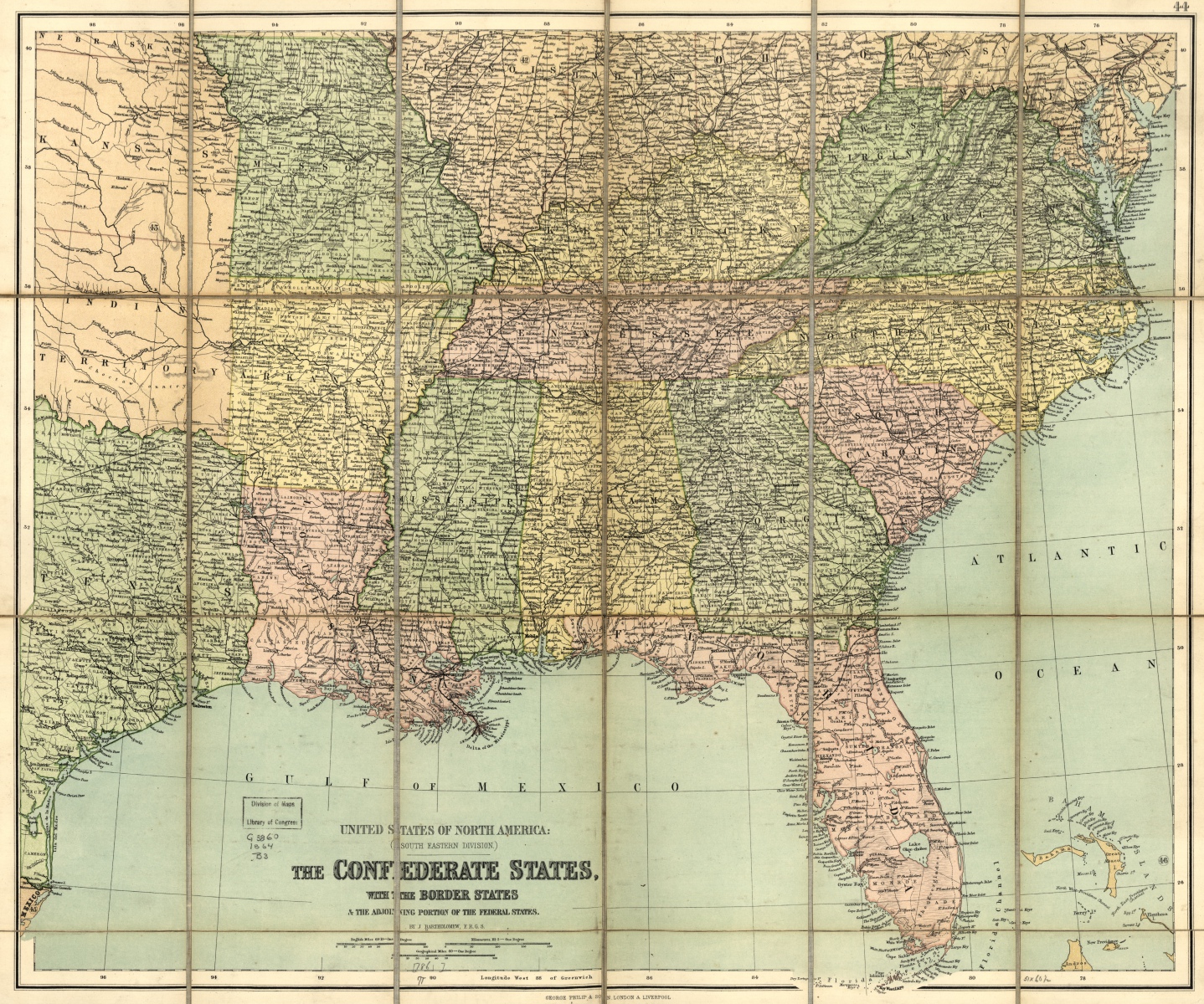
The Confederate states, with the border states & the adjoining portion of the Federal states
Contributor Names:
Bartholomew, John.
Created / Published:
London and Liverpool, George Philip & son, [1864?]
Subject Headings:
- Southern States–Maps
- United States–Southern States
Notes:
- Scale 1:3,600,000.
- LC Civil War Maps (2nd ed.), 48.1
- At head of title: United States of North America: (South eastern division).
- General map showing state names and boundaries, countries, place names, railroads, and rivers.
- Mounted on the verso is an advertisement addressed “to tourists and travellers” describing the merits of the “series of travelling maps.”
- Description derived from published bibliography.
- Available also through the Library of Congress web site as raster image.
Medium:
1 map, col., 52 x 62 cm., cut and mounted to fold to 17 x 11 cm.
Call Number/Physical Location:
G3860 1864 .B3
Language:
English
Online Format:
image
Description:
Scale 1:3,600,000. LC Civil War Maps (2nd ed.), 48.1 At head of title: United States of North America: (South eastern division). General map showing state names and boundaries, countries, place names, railroads, and rivers. Mounted on the verso is an advertisement addressed “to tourists and travellers” describing the merits of the “series of travelling maps.” Description derived from published bibliography.
Additional Metadata Formats:
MARCXML Record
MODS Record
Dublin Core Record
IIIF Presentation Manifest:
Manifest (JSON/LD)
